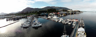
The next day we decided to make tracks out of Welcome Harbor and mosey our way south through the Hecate Strait. Our next planned anchorage was only around 4 hours away, so we took our time in the morning. In hindsight, it may have been better to leave early and get out into the Strait before the wind/swell came up, as our ride was a bit bumpy. We put up some genoa to smooth things out, but it was still not the most comfortable ride as we were traveling pretty much perpendicular to the swell, which “rocked the boat” to say the least.
Chearnley Passage. Most British name ever.
If you strain your eyes and concentrate reeeeeally hard on that last picture...you still can’t see the Charlottes.
After a few hours in the Hecate, we arrived at the Freeman Passage which cuts through Porcher Island and accesses the Kitkatla Inlet. Pretty little passage with some narrow channel areas. At the mouth, I spotted a whale.
Anyone know if this is something other than an orca? I’m still hoping for some non-orca whale spottings. I'm gonna say it is until someone proves me wrong. Ha.
Freeman Passage
Just on the other side of Freeman Passage was our anchorage of choice, known in the guidebook as “Crab Trap Cove.” Apparently the bottom is grassy and highly “productive” for crab fisherman.
Nick had no such luck.
Another gorgeous sunset...
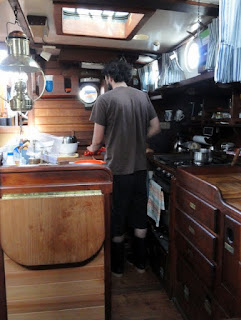
...and dinner cooked with an odd footwear/pant combination.
Unfortunately, it would be the last one of this particular trip (sunsets that is).
Day 4
With the start of Day 4 came the end of the sunny weather. The clouds had rolled in during the night and it was quite foggy with drizzling rain. We took the dinghy out to go find the nearby “white sandy beach” that the guidebook had mentioned. When we arrived, we found the “white” bit, but definitely not the “sandy” part.
Alan was excited anyways
We explored around that and a few other islands and found this creepy looking forest.
Didn’t find any Ents, which I was quite sad about.
Eventually we made our way back to the boat and pulled up the anchor to make our way to Billy Bay, about 1 1/2 hrs south. Rainy and a bit foggy underway. Didn't see a single boat either. Kinda leery.
Our original plan was to go into Gasboat Cove, just east of Billy Bay. The guidebook described both anchorages as good, but claimed that Gasboat was “more intimate.” Well, by “more intimate” they meant “narrower and harder to get in to.” So we went to Billy Bay.
Talofa Lee in Billy Bay
Day 5
Next morning, the fog had rolled in again.
We decided to take another dinghy exploration of the surrounding area. We had seen a few narrow little passes that completely dry during low tide. Naturally, we wanted to see if we could make it through them, or “shoot the gap” as we’ve coined it.
Ya, it got pretty shallow so we paddled through.
On the way back to the boat, we had one of the coolest experiences of the trip. While motoring along, I noticed “a finned creature” surface about 150 feet from the boat so we killed the engine and waited to see it again. Before we knew it, there were around 5 or 6 porpoises surfacing all around the dinghy. The curious little buggers would get closer and closer until one of use moved enough to make noise. At one point one surfaced about 20 ft from the dinghy.
Very very cool.
After the porpoise show, we headed back to the boat to make tracks to our next anchorage. From Billy Bay, our plan was to motor around the eastern side of Porcher Island up to Lawsen Harbor on the northern edge. On our way out of the anchorage, we saw the porpoise again. No pictures, but again, very cool. Before long we were in Ogden Channel, the wide-open (and very deep) body of water on the east side Porcher.
At one point, we were in 1700 feet of water. Gnarly.
A bit later we passed Oona River, a small town/log dump on Porcher Island. Tiny little place. The river is passable by ship, but you have to wait for high tide slack. To make the waiting easier, they dredged out a mooring spot at the mouth of the river. Unfortunately, they only dredged out the exact spot and nothing around it. So if you tied up, fell asleep and woke up during low tide, you’d be stuck in the hole until next tide. How embarrassing.
This is Kelp Passage at the northern tip of Porcher. Our anchorage is on the other end of the passage, but you have to go around to the right a ways as the pass is something like 2 ft deep and packed full of, well, kelp.
"Gnarly sea bush" (aka flotsam) as we call it
After the trip around, we finally anchored in Lawsen Harbor which felt huuuuuuge compared to the other anchorages on our trip. Somewhat relieving really.
Day 6
Day 6 was pretty short, as we woke up early and made the 4 hour jump back into Rupert. Don’t have any pictures from that day somehow, but overall it was pretty uneventful. Only semi-exciting part was refueling at the fuel dock next to the yacht club. Fish boats everywhere = excitement at the fuel dock. We’ve found that fish boat drivers don’t really like going out of their way to avoid other boats. Ya know that whole “shortest distance between Point A and Point B is a straight line” thing? Ya, pretty sure that’s like their doctrine or something. And the fact that they’re all in steel boats that don’t really dent easily doesn’t help matters much either. Anyways, we made it out alive.
Another successful trip for the three of us. Pretty exciting accomplishment if you ask me.


