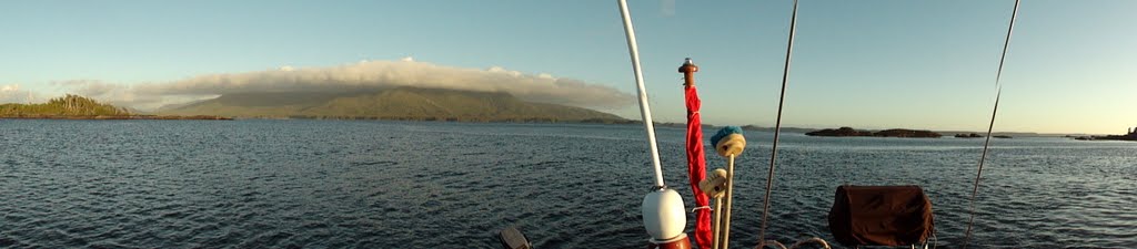
Thursday, July 29, 2010

Haida Gwaii Trip - Day 3

In the morning we made our way over to Skidegate for the Gwaii Haanas Park orientation. Orientations were mandatory for anyone planning to enter the park. It was only about 30 minutes long and had a few interesting tidbits. We also got to walk around the Kaay 'llnagaay Heritage Centre.


Some BIG f'ng beams...

The smell of cedar in this room was entrancing


This is the Haida First Nations symbol for the park.  It's a sea otter and a sea urchin.

After the orientation, we made our way back to the boat.  The tide was OUT (something like 1.3 foot) so the gangplank down to the boat looked more like a ladder.


Unfortunately, to get out of the Queen Charlotte City area, you have to go back the way you came in, which involves going quite a ways north through that channel I mentioned.  This is not ideal if you're then planning to head south like we were.  So we decided we would head over to Sandspit to check it out, then try to cross the sandbar at a higher tide the next day.  

On the way to Sandspit, we had a really nice sail.  20 knot winds, making around 7.5 knots wing-on-wing.  Fun times at the helm.


After a few hours, we arrived at the brand-spankin'-new yacht club in Sandspit called Shingle Bay.  Very nice place with a massive breakwater.  Stopped to get gas before tying up.

Does this guy not remind you of Tweedle Dum/Dee from Alice in Wonderland?  That hat in amazing.

Shingle Bay

Again, Nick, Alan and I decided to go exploring.  The yacht club was a ways SW Sandspit itself, but there was a super-long beach to stroll along.  


Turns out, Sandspit (or that beach rather) is pretty much Rope Swing City.  We must have found 4-5 of them along the way.  Awesome times were had.

Semi-Pro Rope-swinger Alan nailing the Look Back

Nick with awesome extension

Me takin' my hands off.  Siiiick

If I've learned anything on this trip, it's that I like rope swings.

Haida Gwaii Trip - Day 2

We awoke at 5 am in order to get a nice early start to our Hecate crossing.  We were told that it can take around 15 hours, so we wanted to get as much daylight as possible.  Sunrise was quite pretty and conditions were nice and calm in the bay.


The weather forecast was for NW winds around 15 knots, shifting to SW later in the evening.  NW winds are great.  Not so much with SW, for reasons I will now explain.

Now for those that don’t know the area, the Hecate Strait is the large body of water between the Queen Charlotte Islands and the BC mainland.  From south to north, it’s kind of shaped like a funnel, getting narrower and shallower.  This can cause some gnarly conditions to form during storms and such.  It has actually been called the 3rd most dangerous seas in the world in regards to weather caused accidents/emergencies.  Anyways, southern winds cause the swells to move up “the funnel” where they get constricted by the shores and amplified by the shallow water.  In other words, not good conditions to be crossing.  However, we expected NW winds for most the day, which are prime for our crossing route. 

Leaving Arthur Island around 5:30am, we were immediately hit with 1-2 m choppy swells in “the Hell Hole.”  We had a very Deadliest Catch/Perfect Storm moment (well, toned down slightly/extremely) at one point when the bow buried itself into an oncoming wave, completely submerging and sending A LOT of water back into the wheelhouse window.  Unfortunately for us, we had a few portholes still open from the night before, so a large amount of that water poured in to the head and saloon down below.  No real harm, just a mess to clean up.  Thankfully, we got into Chearnely Passage and the water calmed down significantly.  We popped up the main, putting a single reef in just to be cautious and headed out into the Hecate.  Our crossing had begun.


Leaving the mainland behind.

Well, with as much unsure anticipation which we all had, our crossing was sure to be much less eventful than expected.  And, well, it was.  The winds set it at around 15-20 knots from the NNW, the swell never got anywhere as big as it was in the Hell Hole, and we basically sailed the same course for ~50 miles from one side to the other.  Pretty uneventful really, which in all consideration, is a GOOD THING.

This is one of the THREE waypoints we had to work with during our crossing.  Rest was all dead reckoning.

Conditions threatened to get ugly, but never did.  In fact it was bluebird sunny by the end of the day.

One kind of crazy thing was just how shallow it gets in the middle of the Strait.  We were probably 20+ miles off shore and the water was only 50 feet deep.  Definitely a shocking change from sailing up here in fjords that were 150+ deep, 25 feet from shore.  Right out in the middle, we ran into a sea of crab traps.  Spaced about 100m apart in nice straight lines, they would extend off as far as you could see in both directions.  I forgot to get a picture, so you’ll just have to believe me.


Within about 20 miles of Lawn Point, we saw the ferry coming out.


Like I mentioned, the weather was actually quite pleasant towards the end of our crossing. 


Nick working hard.

Just about there

The last bit of the cross involves a pretty narrow channel surround by sandbanks that were as shallow as 1 ft deep.  The channel is well marked with buoys, so it was basically a big game of connect the dots.  However, we were pretty happy to have encountered the ferry out in open water and not in that channel.  Would have been a bit tight.


That triangular looking thing on the top of that last picture is a pretty neat gadget of nautical navigation.  There was a marker light on the shore that, depending on your orientation to it, would appear as different colors.  If you were in the top triangle, it would look red, middle white, and bottom green.  Pretty neat if you’re a navigation nerd like me.

After the channel navigation, we tied up in Queen Charlotte City.  We arrived fairly early in the afternoon, so Nick, Alan and I decided to go ashore to scope things out.

Queen Charlotte City

Dock kitty

Best boat name ever?


We found a bunch of old abandoned machinery down on the beach.  No idea what it was.  Possibly equipment for pulling boats out of the water?


We stopped off at the Visitors Center, just in time to catch a presentation on inter-tidal species.  Quite interesting slideshow, which proved useful as we were experiencing almost 0 foot tides.

Back at the boat, we'd had a break-in. 

Sneaky bugger slid in through a tiny hole in the canopy.

Sunday, July 25, 2010

Haida Gwaii Trip - Day 1

The Captain arrived this afternoon around 3:30pm while Alan, Nick and I were making shopping for 2 weeks worth of food.  2 weeks of food for 4 people ends up being quite a bit.  I wish I had had my camera with me to get a picture of the checkout counter.  I felt bad when the clerk told us she was hurrying through stuff because she was actually 5 minutes past her quitting time.  Poor women. 

Once we got everything stored away on the boat (around 3pm), we said our goodbyes to the Donohoes and pulled away from the dock.  The wind was pretty fresh at around 15-20 knots from the SW.  Motoring out of the harbor was uneventful for the most part, though we did run into the ferry (again) in the same narrow spot in the harbor as before.  Always a bit exciting. 


On the way out of the harbor, we saw the C.S. Poopstain loading (*chuckle*).


Little while later the wind shifted to NW and we decided to throw the mainsail up.  Once out of the harbor, we were booking along at around 7 knots with a 20 knot wind.  Seas were around 1 meter with some chop, but the ride wasn’t too bad.  The weather itself was amazing with a nice warm sun beating into the wheelhouse.  As the wind was a bit more westerly than we would have liked, we eventually had to make a few tacks to get where we wanted to go.  Overall a gorgeous time on the water. 


Once we got to Edye Passage (aka the “Hell Hole” as I mentioned before), we had to take the main down.  I had a bit of an exciting moment as the sail was coming down.  With the sail luffing into 20 knots of wind, it was banging around quite a bit.  As we started to let it down, I was aft trying to keep it coming straight down onto the wheelhouse roof.  Well in the violent thrashing of the sails, the reefing lines tried to wrap themselves around my neck, which was, to say the least, uncomfortable for me.   No harm done (though I almost lost my sunglasses), just a bit scary.

Around 9pm we finally anchored in a bay on Arthur Island.  Very nice colors during sunset.  Dinner was chili that Alan made.  Tomorrow we’re trying the Hecate.


Anchored at Arthur Island

A rare sighting in Prince Rupert!

The Great Northern Yellow-tailed Albatross

Friday, July 23, 2010

Porcher Island Trip - Part 2

Day 3

The next day we decided to make tracks out of Welcome Harbor and mosey our way south through the Hecate Strait.  Our next planned anchorage was only around 4 hours away, so we took our time in the morning.  In hindsight, it may have been better to leave early and get out into the Strait before the wind/swell came up, as our ride was a bit bumpy.  We put up some genoa to smooth things out, but it was still not the most comfortable ride as we were traveling pretty much perpendicular to the swell, which “rocked the boat” to say the least. 

Chearnley Passage.  Most British name ever.


If you strain your eyes and concentrate reeeeeally hard on that last picture...you still can’t see the Charlottes.

After a few hours in the Hecate, we arrived at the Freeman Passage which cuts through Porcher Island and accesses the Kitkatla Inlet.  Pretty little passage with some narrow channel areas.  At the mouth, I spotted a whale.


Anyone know if this is something other than an orca?  I’m still hoping for some non-orca whale spottings.  I'm gonna say it is until someone proves me wrong.  Ha.

Freeman Passage

Just on the other side of Freeman Passage was our anchorage of choice, known in the guidebook as “Crab Trap Cove.”  Apparently the bottom is grassy and highly “productive” for crab fisherman. 

Nick had no such luck.

Another gorgeous sunset...

...and dinner cooked with an odd footwear/pant combination.  

Unfortunately, it would be the last one of this particular trip (sunsets that is).
 
Day 4

With the start of Day 4 came the end of the sunny weather.  The clouds had rolled in during the night and it was quite foggy with drizzling rain.  We took the dinghy out to go find the nearby “white sandy beach” that the guidebook had mentioned.  When we arrived, we found the “white” bit, but definitely not the “sandy” part.


Alan was excited anyways

We explored around that and a few other islands and found this creepy looking forest.


Didn’t find any Ents, which I was quite sad about.

Eventually we made our way back to the boat and pulled up the anchor to make our way to Billy Bay, about 1 1/2 hrs south.  Rainy and a bit foggy underway.  Didn't see a single boat either.  Kinda leery. 


Our original plan was to go into Gasboat Cove, just east of Billy Bay.  The guidebook described both anchorages as good, but claimed that Gasboat was “more intimate.”  Well, by “more intimate” they meant “narrower and harder to get in to.”  So we went to Billy Bay.

 Talofa Lee in Billy Bay

Day 5

Next morning, the fog had rolled in again.


We decided to take another dinghy exploration of the surrounding area.  We had seen a few narrow little passes that completely dry during low tide.  Naturally, we wanted to see if we could make it through them, or “shoot the gap” as we’ve coined it.


Ya, it got pretty shallow so we paddled through.


On the way back to the boat, we had one of the coolest experiences of the trip.  While motoring along, I noticed “a finned creature” surface about 150 feet from the boat so we killed the engine and waited to see it again.  Before we knew it, there were around 5 or 6 porpoises surfacing all around the dinghy.  The curious little buggers would get closer and closer until one of use moved enough to make noise.  At one point one surfaced about 20 ft from the dinghy. 


Very very cool.

After the porpoise show, we headed back to the boat to make tracks to our next anchorage.  From Billy Bay, our plan was to  motor around the eastern side of Porcher Island up to Lawsen Harbor on the northern edge.  On our way out of the anchorage, we saw the porpoise again.  No pictures, but again, very cool.  Before long we were in Ogden Channel, the wide-open (and very deep) body of water on the east side Porcher.

At one point, we were in 1700 feet of water.  Gnarly.

A bit later we passed Oona River, a small town/log dump on Porcher Island.  Tiny little place.  The river is passable by ship, but you have to wait for high tide slack.  To make the waiting easier, they dredged out a mooring spot at the mouth of the river.  Unfortunately, they only dredged out the exact spot and nothing around it.  So if you tied up, fell asleep and woke up during low tide, you’d be stuck in the hole until next tide.  How embarrassing.


This is Kelp Passage at the northern tip of Porcher.  Our anchorage is on the other end of the passage, but you have to go around to the right a ways as the pass is something like 2 ft deep and packed full of, well, kelp.


"Gnarly sea bush" (aka flotsam) as we call it

After the trip around, we finally anchored in Lawsen Harbor which felt huuuuuuge compared to the other anchorages on our trip.  Somewhat relieving really.


Day 6

Day 6 was pretty short, as we woke up early and made the 4 hour jump back into Rupert.  Don’t have any pictures from that day somehow, but overall it was pretty uneventful.  Only semi-exciting part was refueling at the fuel dock next to the yacht club.  Fish boats everywhere = excitement at the fuel dock.  We’ve found that fish boat drivers don’t really like going out of their way to avoid other boats.  Ya know that whole “shortest distance between Point A and Point B is a straight line” thing?  Ya, pretty sure that’s like their doctrine or something.  And the fact that they’re all in steel boats that don’t really dent easily doesn’t help matters much either.  Anyways, we made it out alive.

Another successful trip for the three of us.  Pretty exciting accomplishment if you ask me.